This version updates the spread configuration to enable a CMP Multiplier to adjust CMP totals for lines where a large range of receiver groups are missing and the CMP is adjusted by part of a CMP line.
Category Archives: CheckPoint v2
Updates to CheckPoint v2
CheckPoint 2.0.295 Released
This version contains two minor updates
- Updated Report Generation for Text Titles
- Updated Backup and Restore for Attribute Data
CheckPoint 2.0.294 Released
This version updates the data entry error display to work correctly for Site Survey KP logging
CheckPoint 2.0.293 Released
This version contains the following updates
- Added Single Corridor Summary to Report Output
- Updated System to Avoid Running Multiple Sync Managers
CheckPoint 2.0.292 Released
This version contains the following updates
- Updated Ordering of Preplot and Perimeter in Displays
- Updated Corridor Outputs for Site Survey Projects
- Added Option to Remove Corridor Lines from Line Plan
CheckPoint 2.0.291 Released
This version contains the following updates
- Updated Map Key for Preplots with Multiple Sections.
- Added Corridor Split into Line Plan for Site Surveys
- Updated P1 Mapping Tool to show Attribute Value at Mouse Location
- Updated P1 Mapping Tool to load and display P1 Spread for Line and Shot
- Updated P1 Mapping Tool to load and display data from SBS attributes
CheckPoint 2.0.290 Released
This version contains the following updates
- Added Option to Remove Shot Range from P1 Attribute Generation
- Added Preplot Totals into Acquisition Summary Table
- Added Node Activities into Hybird Survey
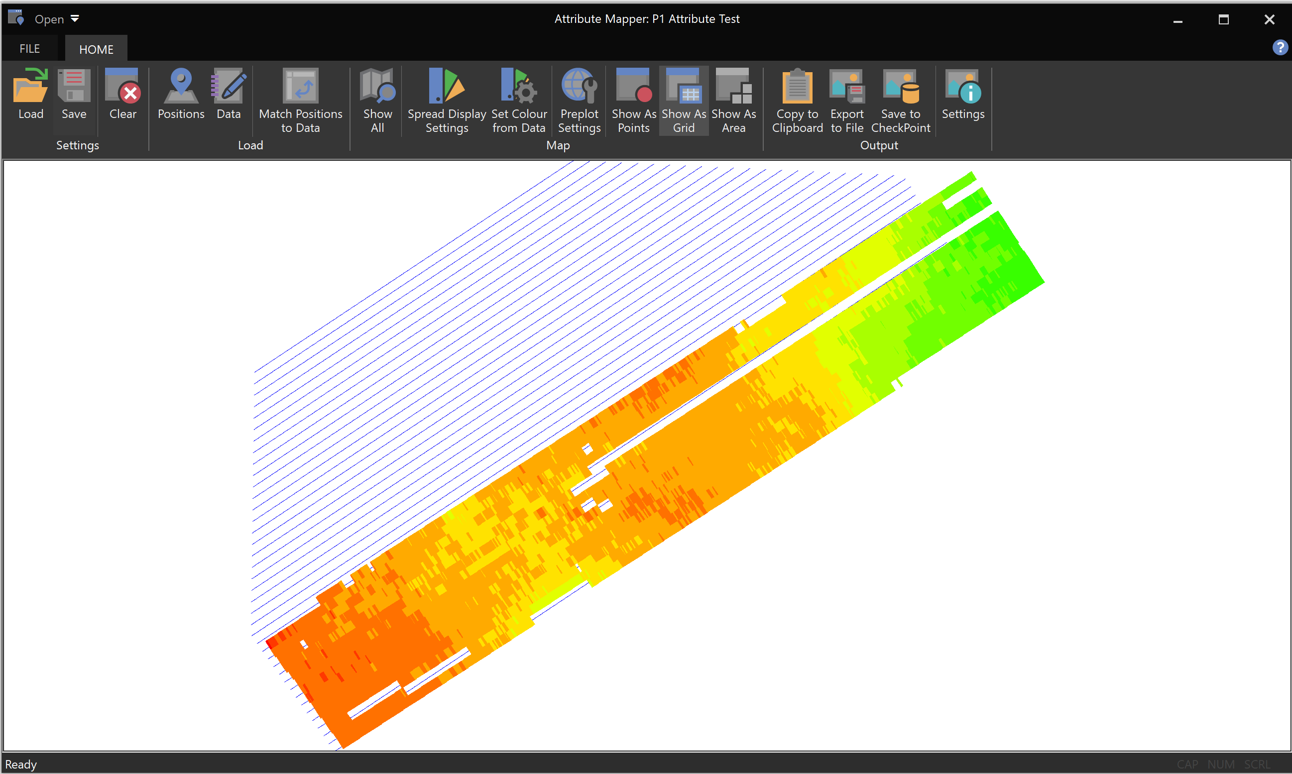
- Updated P1 Mapping Tool to show Spatial Attributes
The P1 mapping tool has been updated to generate spatial maps using the loaded P1 attributes
CheckPoint 2.0.289 Released
This version updates the P1 attribute generation process to allow for a range of shots to be ignored.
CheckPoint 2.0.288 Released
This version contains the following updates
- Added Individual Gun Depth to P1 Attribute Dataset
- Added Support for Marine Rep Details
CheckPoint 2.0.287 Released
This version contains two specific reporting outputs for a Geotechnical survey.