BreakPoint is an advanced system for the management, visualisation, positioning and quality control of source and receiver points for Land, Transition Zone and Ocean Bottom Sensor Surveys
- First Break Positioning
- Preplot Comparison
- Easy to Setup, Configure and Use.
- Graphical Displays to aid Configuration and Setup
- Generation of Reports and GIS Outputs.
- Powerful Information Displays.
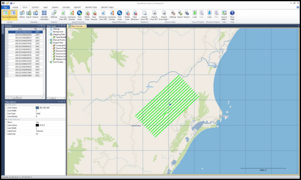
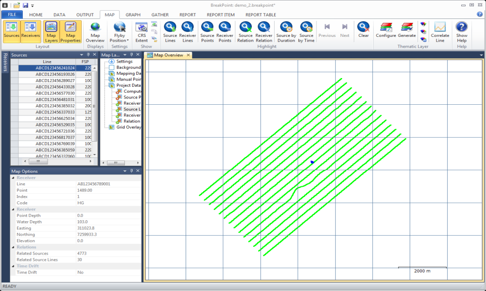
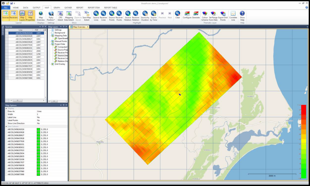
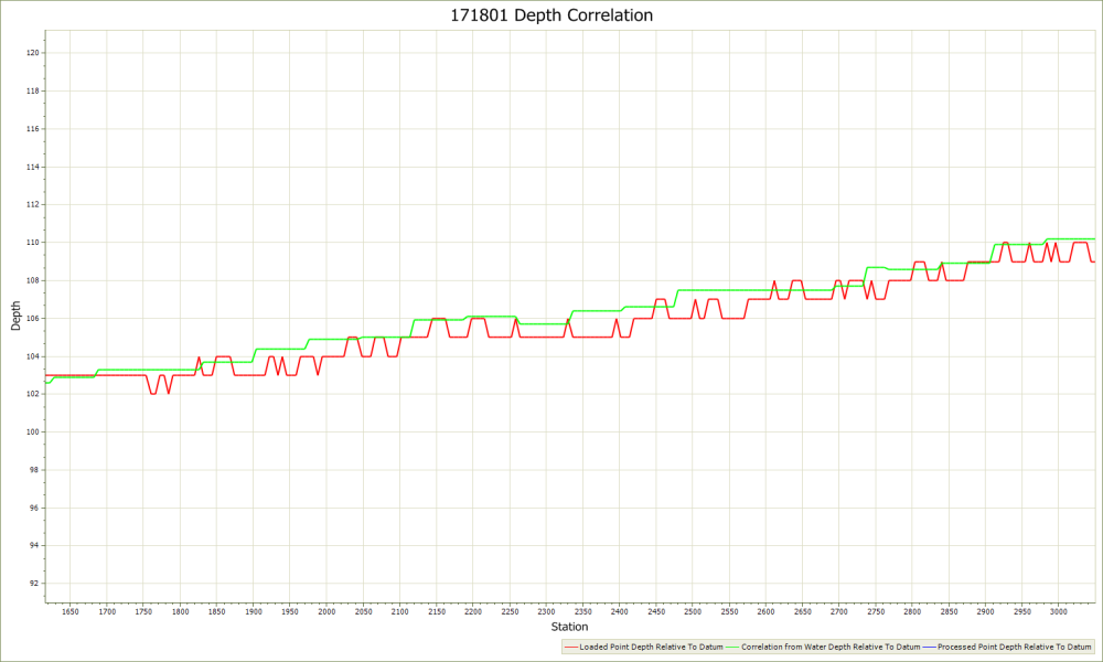
Visualisation of Field Positions
Field and preplot positions can be loaded, visualised and analysed graphically.
Shot Edits can be applied and source to receiver relations can be visualised
Positions can be exported in SPS and GIS formats
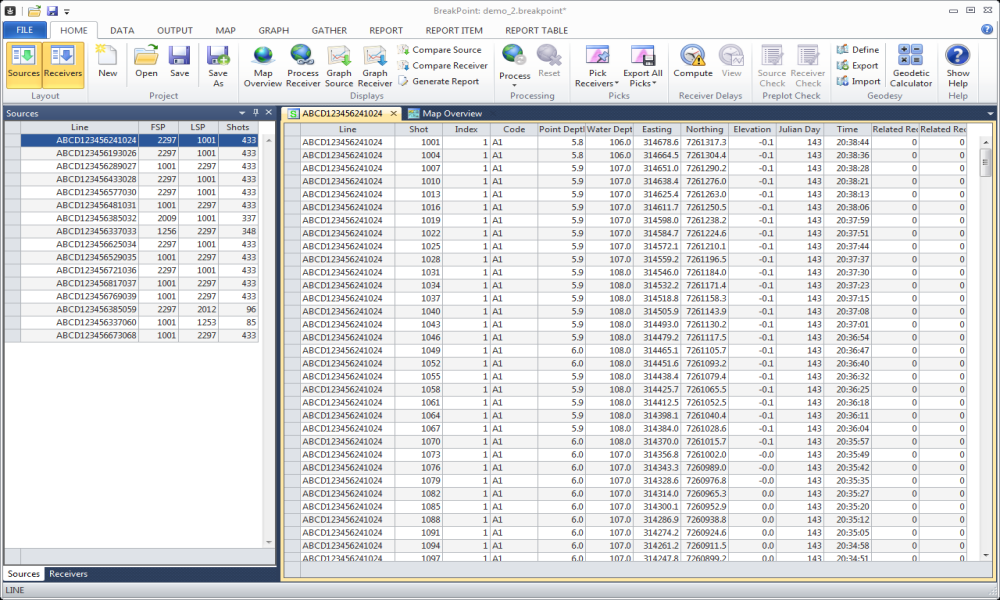
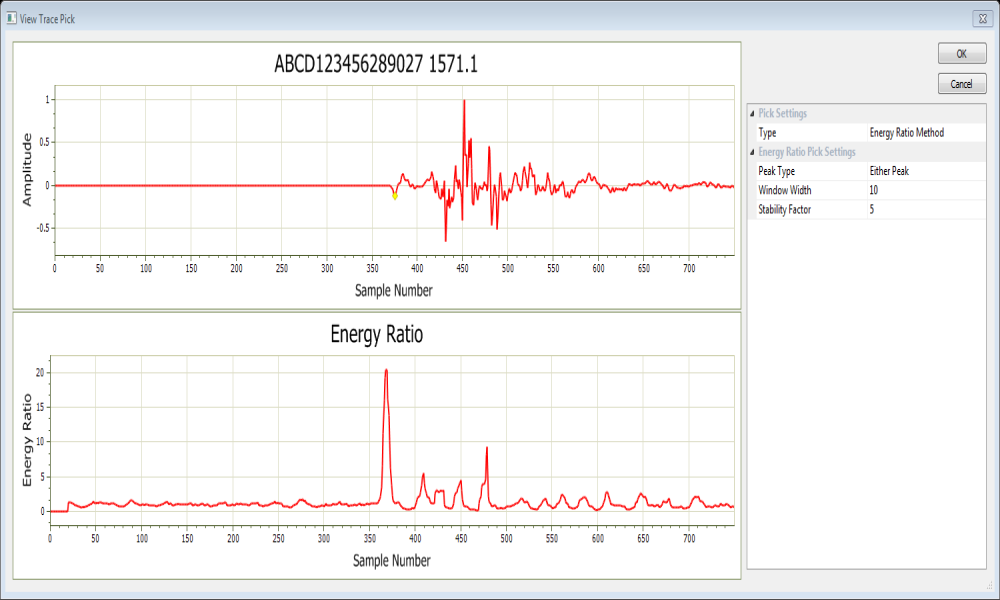
Positioning from First Breaks
Traces can be loaded from SEGY and the first break picked automatically or interactively
The picks are used to generate a velocity model which is then used to compute a new position for the receiver.
Receiver elevations can be generated from the source elevation data using a number of gridding techniques
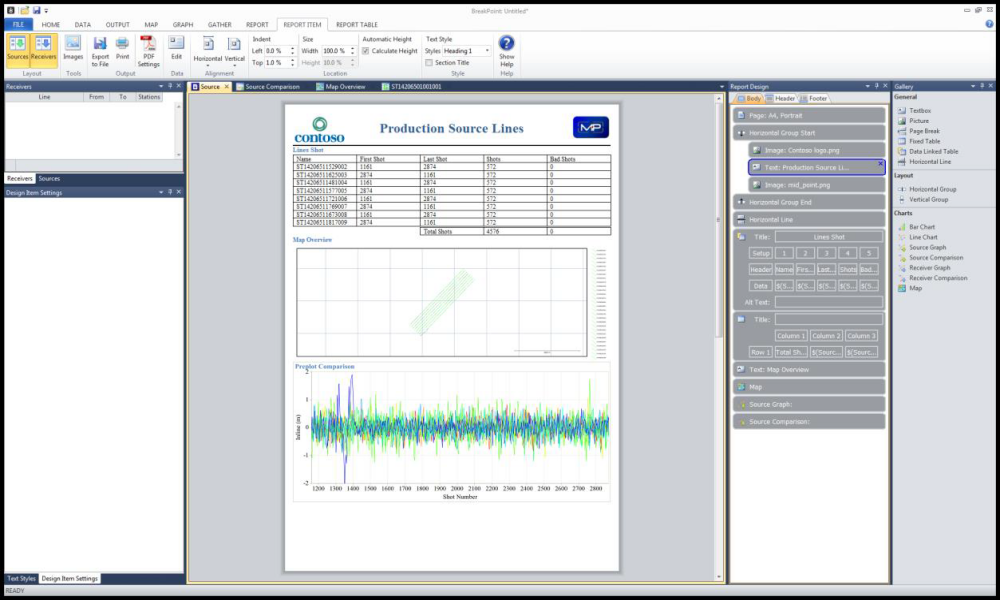
Flexible Report Generation
The BreakPoint Reporting module extracts the data from the system and turns this into a bespoke report which can be printed or exported in PDF, Word or Excel formats.
The reports are customisable, with the user able to adjust layout and presentation, as well as to build new report layouts from scratch.
All common report elements, such as charts, text, maps and images are available.